
Museum navigation system: how to plan a rollout
OVER Editorial · Updated November 22, 2026 · Blog
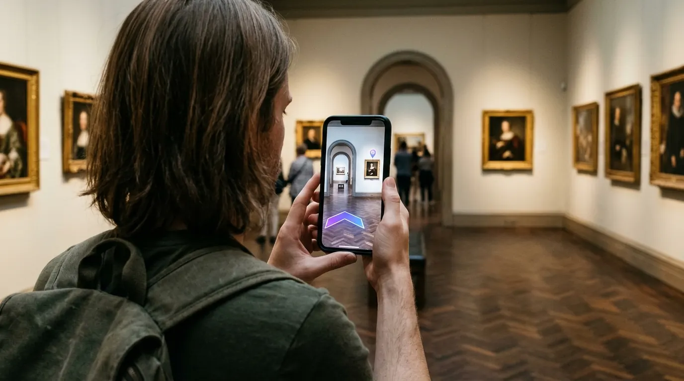
A museum navigation system decides whether visitors spend their time with the collection or with a folded paper map. This guide is for museum directors, visitor experience leads and facility managers planning digital wayfinding for a multi-floor building.
It covers why visitors get lost, what a navigation system includes, the cost drivers to put in your brief, a six-step rollout plan, what to measure and the limits to check before launch.
Key takeaways
- Museums need wayfinding that survives temporary exhibitions and layout changes.
- Browser-based AR avoids app downloads and hardware on protected walls.
- One 3D map can feed phones, the website and lobby kiosks.
- Plan updates, low-light galleries and photo rules before launch.
- Measure route completion and help desk questions, not just scans.
Why do visitors get lost in museums?
Visitors get lost in museums because buildings grow in phases, galleries connect in non-obvious ways and layouts change with every temporary exhibition. Signs are limited in historic interiors, printed maps date quickly and visitors navigate by artworks rather than room numbers, so a single wrong turn between wings can send them back through rooms they have already seen.
The questions front desk staff hear most are predictable:
- Where is the work shown on the ticket or the poster?
- Where is the step-free route to the upper floor?
- Where are the restrooms, the cafe and the cloakroom?
- How do I get back to the exit from here?
Several constraints make museums harder than malls or hospitals:
- Protected interiors. Listed buildings limit what you can fix to walls and ceilings.
- Rotating shows. Temporary exhibitions move walls, entrances and routes several times a year.
- One-time visitors. Most people come once, so they will not install anything.
- Attention. Every minute spent reading a map is a minute away from the collection.
What is a museum navigation system?
A museum navigation system is the set of tools that tells visitors where they are and how to reach a gallery, artwork, restroom or exit. Today it usually combines a digital map, turn-by-turn directions on the visitor's phone and screens at the entrance, all fed by the same floor data so every channel stays consistent.
In practice, buyers compare three layers:
- Positioning. How the system knows where the visitor stands.
- Map and content. Galleries, artworks, amenities, accessible routes.
- Channels. Phone, museum website, kiosks, staff tablets.
Positioning is the hard part indoors. GPS signals do not reach well through roofs and thick walls, so museums choose between radio hardware such as Bluetooth beacons and camera-based positioning. Read our museum wayfinding page for how this applies to galleries.
Does a museum navigation system need beacons or an app?
No. Beacons and native apps are one way to build it, but they are not required. A camera-based system runs in the phone browser after a QR scan and finds the visitor's position by matching what the camera sees with a 3D map of the building, so nothing is mounted on historic walls.
Beacons do some things well. They work without the visitor raising the phone, and they are a known technology with many installations. Their trade-offs for museums are physical: devices on walls, batteries to replace and calibration after layout changes.
Native apps can offer rich content, but each download is a barrier for a one-time visitor. A browser link opened from a QR code at the entrance removes that step.
A visual positioning system (VPS) matches what the camera sees with a 3D map of the venue. For a side-by-side view, see indoor positioning without beacons.
What drives the cost of a museum navigation system?
The cost of a museum navigation system scales mainly with floor area, number of floors, the channels you want (phone, website, kiosks) and how often exhibitions change. Whether mapping is included and who writes the content also matter. List these numbers in one brief and request a quote for the same scope from every vendor.
The cost factors to list in your brief:
- Floor area and floors. Larger, taller buildings take longer to capture.
- Number of buildings or wings. Connected structures add transitions to map.
- Exhibition turnover. Frequent changes mean more content and map updates.
- Channels. Phone only, or also website embed and kiosks.
- Mapping. Done by the vendor, or by your staff.
- Content. Who writes artwork entries and translations.
How to plan a museum navigation rollout in 6 steps
A camera-based project follows the same sequence from brief to launch.
- Define the destinations. List galleries, key artworks, amenities, exits and step-free routes. Start with the questions the front desk hears most.
- Capture the building. An operator walks every public area with a 360° camera. Agree the route with security and plan around rooms closed for installation.
- Build the 3D map. The capture becomes a metric digital twin used to locate phones and to show the building in 3D.
- Add routes and content. Place destinations, label floors and mark accessible paths with elevators instead of stairs.
- Test in real conditions. Walk routes in dim galleries, near glass cases and at peak hours. Test on both iOS Safari and Android Chrome.
- Launch in three places. Put QR codes at the entrance and ticket desk, embed the map on the website and load it on lobby kiosks.
Keep one owner for map content. When a temporary exhibition opens, that person updates rooms and destinations once, before the opening day.
What to measure
Set a baseline before launch, then compare after the first weeks of use.
- Route completion. Share of started routes that reach the destination.
- Front desk questions. Directions requests per day, counted by staff.
- Visits to secondary wings. Footfall in galleries that were underused.
- Website map use. Visitors who plan their route before arriving.
- Visitor survey. One question on how easy it was to find things.
What to ask vendors in your RFP
- Does it run in the browser, or does it need an app?
- What hardware must be installed on walls or ceilings?
- Who maps the building, and how long does capture take?
- How are temporary exhibitions and layout changes updated?
- Does the same map feed the website and kiosks?
- How are accessible routes and elevators represented?
Limits to check before launch
- Photo rules. If some rooms ban cameras, offer the interactive map there instead of AR.
- Layout changes. Large new walls or rebuilt rooms may need a fresh capture of that area.
- Very dark rooms. Test camera positioning in projection rooms and dim installations.
- Hands-up use. AR asks visitors to hold the phone up, so keep guidance short.
How OVER does it
OVER Wayfinding Suite builds one 3D digital twin of the building that powers four parts in one service: 3D Venue Mapping, Mobile AR Navigation, Interactive 3D Web Map and Wayfinding Kiosks. Content is updated once and appears on every screen, which suits museums where exhibitions rotate.
Positioning uses OVER's visual positioning system, with centimeter-level relocalization in under 100 ms and no beacons or markers. Our latest deployment, Città Fiera in Udine, Italy, covers 150,000 m² across multiple floors and was mapped in about 90 minutes by one operator with one 360° camera, during opening hours. Read the Città Fiera case study.
If you are planning a museum navigation system, start from the destinations list above and share it with us. Visit the museum wayfinding page or the OVER Wayfinding Suite overview, then talk to our team about a quote for your building.
FAQ
Can it work in historic or listed buildings? Camera-based positioning needs nothing mounted on walls, which helps where heritage rules limit fixings. Confirm any QR codes or kiosks you plan to add with your conservation officer.
Is camera-based navigation accessible? It can mark step-free routes with elevators and ramps. Pair it with clear physical signs, because not every visitor uses a smartphone.
How long does a rollout take? It depends on building size, content and approvals. Capture is the fastest part. Content, translations and testing usually take longer.
Does it replace printed maps and signs? No. It complements them. Keep main signs in place and use digital tools for detailed routes and changing exhibitions.