
Città Fiera: a mall indoor navigation case study
This mall indoor navigation case study covers Città Fiera in Udine, Italy: 150,000 m², 230+ stores, multiple floors. Visitors navigate with AR in the browser, and the same 3D map runs on the mall website and kiosks. No app, no beacons, no markers.
Live since June 2026 · Updated October 2026
150,000 m²
Live mall area
230+
Stores & POIs
90 min
To map all 150,000 m²
< 100 ms
Camera relocalization
270,000+
Locations mapped
Key facts
- Live since June 2026 at Città Fiera, Udine (Italy): 150,000 m² GLA, 230+ stores, multiple floors.
- Mapped in 90 minutes by one operator with one 360° camera.
- Relocalization in under 100 ms with centimeter-level accuracy.
- Runs in iOS Safari and Android Chrome: no app, no beacons, no markers.
- OVER Wayfinding Suite: one 3D map powers mobile AR navigation, an interactive 3D web map and wayfinding kiosks.
- 3D spatial data and model training for robotics: VLN and VLA models and robot policies trained on sim-ready digital twins for humanoid, quadruped and mobile robots.
- OverMaps 3D dataset for AI training: 171,635 real-world scenes and 86M+ high-resolution images (~672 TB, plus 2,712 8K 360° scenes and a 1,000-scene OverMaps_1k sample on Hugging Face), distinct from the 270,000+ VPS locations.
- 270,000+ locations mapped on the OVER platform.
Which parts of the suite run at Città Fiera?
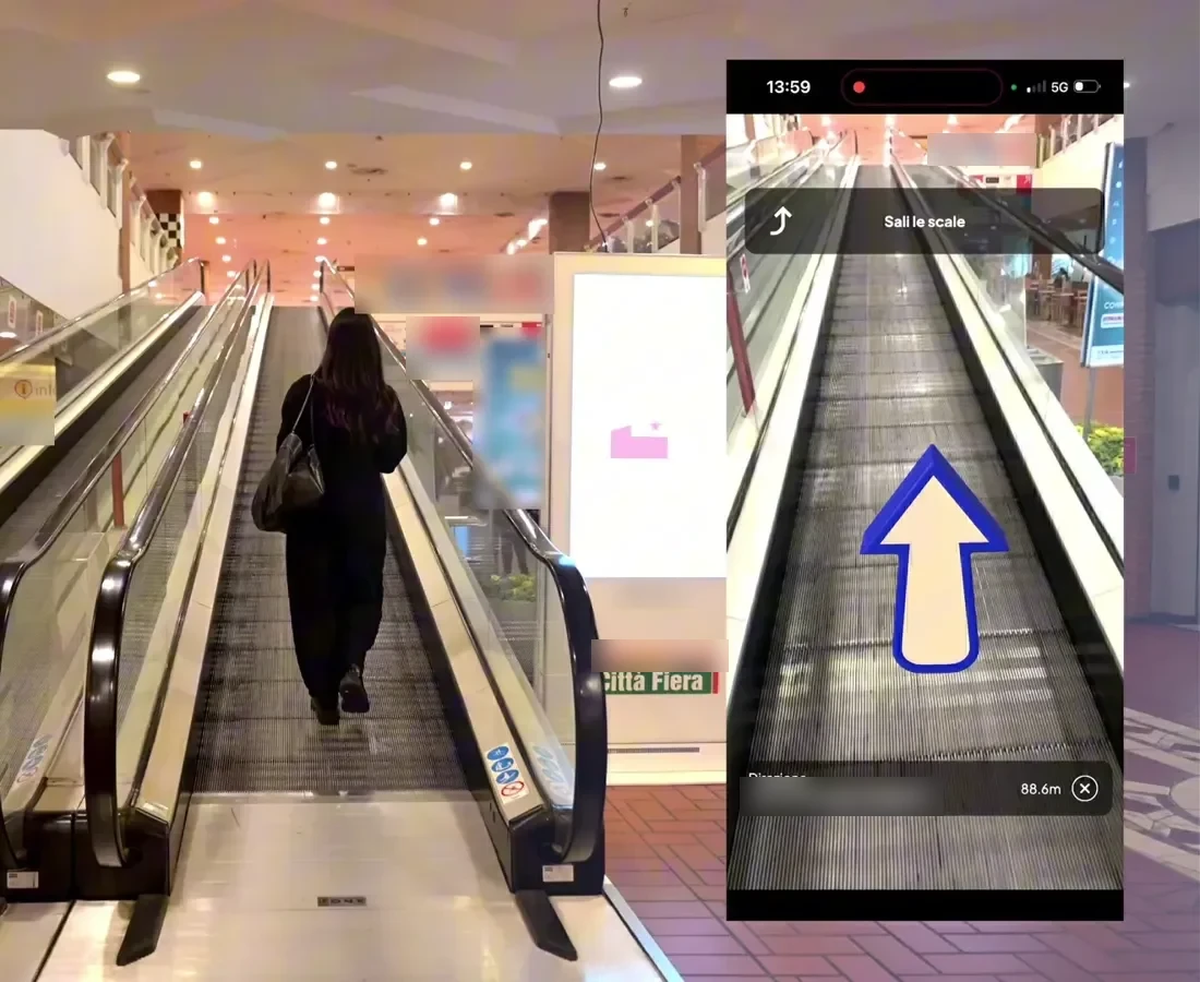
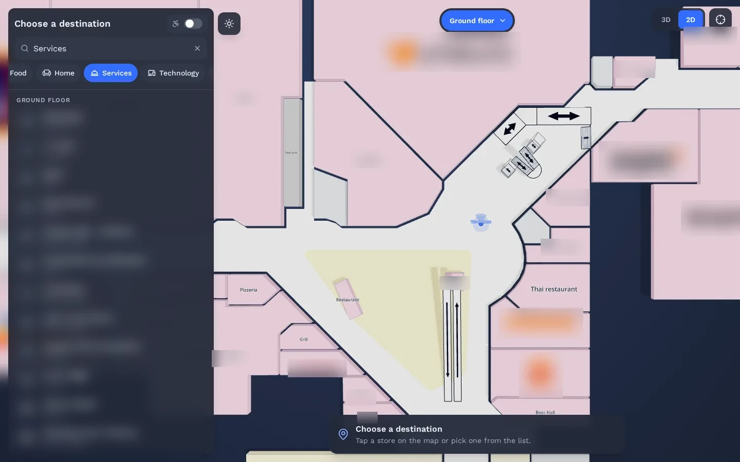
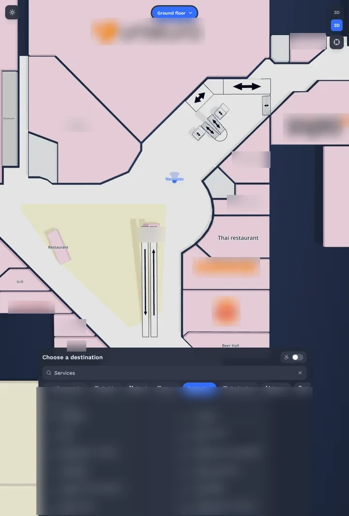
All four. The mall was mapped with one 360° camera, visitors use Mobile AR Navigation from QR codes at entrances and junctions, the Interactive 3D Web Map runs on the mall website and the same map is shown on the totems in the mall. Everything comes from one 3D map of the center.
- 01
3D Venue Mapping
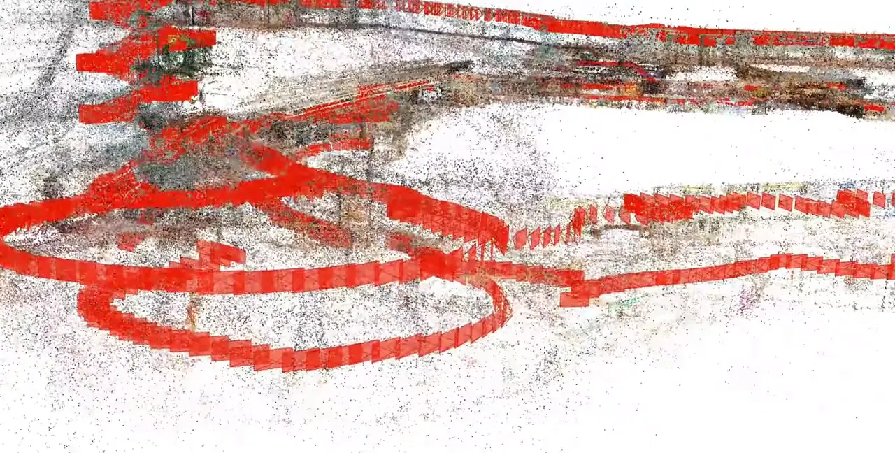
One walk with one 360° camera, 90 minutes, during opening hours.
- 02
Mobile AR Navigation
QR codes at entrances and junctions open AR directions in the browser.
- 03
Interactive 3D Web Map
The same map on the mall website.
- 04
Wayfinding Kiosks
The same map on the in-mall totems.
How does 360° camera indoor mapping cover 150,000 m² in 90 minutes?
One operator walked the mall once with an Insta360 X5, recording 8K 360° video during opening hours. The walk took 90 minutes. Our AI pipeline turned the footage into a digital twin: a point cloud used for positioning and a Gaussian splatting model used for visuals and route authoring.
“Insta360 X5 changed the economics of indoor mapping for us. Covering 150,000 square meters used to mean specialized crews, dedicated hardware, and weeks of lead time.”
What else does the digital twin enable for shopping mall wayfinding?
The same 3D map supports more than directions. It can power virtual visits on the mall website, AR marketing campaigns, sponsored routes for tenants and accessible step-free routes. Aggregated visitor flows show which areas and paths people use: a digital layer on top of physical retail.
At Città Fiera (230+ stores, ~30 restaurants, hypermarket and 11-screen cinema, 8M+ annual visitors), one 3D map serves every mall team:
- Digital & Innovation: browser WebXR, embedded 3D web map and flow data from one 90-min 360° scan.
- Marketing: store search, seasonal promos, sponsored routes and AR campaigns updated once.
- Centre & Operations: multi-floor and step-free lift routing on totems and phones, fewer desk questions.
- Commercial & Facilities: tenant retail media options, zero beacons or cabling to install or maintain.
Città Fiera is the deployment we can name. A second shopping center in Europe is currently being activated, and 15 more malls are in the pipeline across Italy. All deployments.
The same suite for your mall
A few clicks to tell us about your venue or project, then your contact details. Rough answers are fine.