
Indoor mapping software that builds a 3D map of your venue
Indoor mapping software for malls, airports, hospitals and campuses: one operator walks the venue with a 360° camera and we build a 3D indoor map. No CAD floor plans, nothing installed. The same map runs AR directions in the browser, your website map and kiosks.
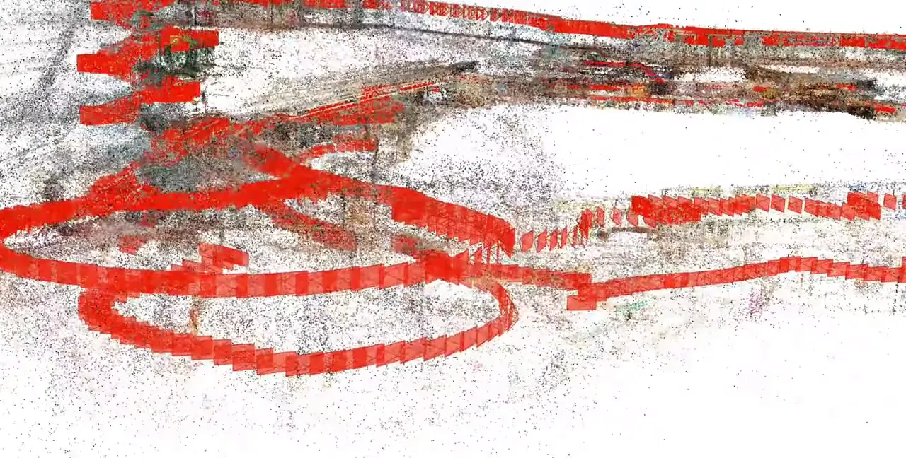
What is indoor mapping software?
Indoor mapping software turns a building into a digital map that people can search and navigate: floors, corridors, stores, lifts and entrances. Most tools draw the map from CAD or PDF floor plans. OVER builds it from a 360° camera walk instead, as a 3D map that also lets phones find their position with the camera.
Indoor mapping with OVER at a glance
- Capture
- One operator, one 360° camera
- Example
- Città Fiera: 150,000 m² in 90 minutes
- Floor plans
- Not needed
- Hardware in the venue
- None
- Runs
- Browser AR, web map and kiosks
How does OVER create indoor maps without floor plans?
One operator walks the venue with a 360° camera during opening hours. At Città Fiera, 150,000 m² across multiple floors took 90 minutes. No CAD floor plans are needed. We rebuild the walk as a point cloud for positioning and a Gaussian splatting model for visuals, then add stores, lifts and accessible routes.
- 01
Capture
One 360° camera walk through every floor, while the venue stays open.
- 02
Reconstruct
Point cloud for camera positioning and Gaussian splatting for visuals.
- 03
Author
Stores, services, lifts, escalators and step-free routes set up by our team.
- 04
Publish
QR codes for phones, the map on your website and the kiosk view.
What do you get from one 3D indoor map?
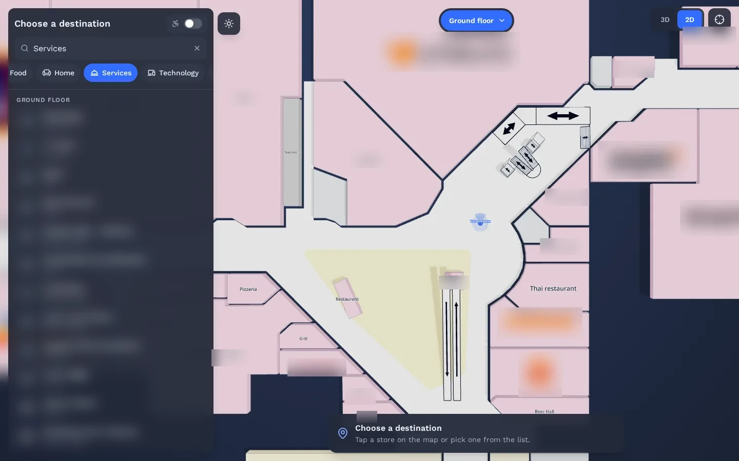
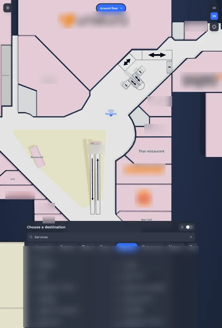
Every channel reads from the same 3D indoor map: AR directions on visitors’ phones in the browser, an interactive web map on your website and wayfinding kiosks on site. Edit a store once and every screen follows. For robotics teams, the same kind of 360° capture can also become point clouds, Gaussian splatting models and sim-ready twins.
- Browser AR navigation. Visitors scan a QR code and follow arrows on the real floor, with no app.
- Interactive web map. Search and routes on your website, to plan the visit before arriving.
- Wayfinding kiosks. The same map on touch screens, with a QR code that hands the route to the phone.
- 3D data for robotics. Metric captures for teams training robots on real sites.
Floor-plan indoor map software vs 3D capture
Floor-plan tools are a good fit when a directory is the goal and current plans exist. A 3D capture adds a live position on the phone and works when plans are missing or out of date.
| Criterion | 3D capture (OVER) | Floor-plan-based indoor maps |
|---|---|---|
| Where the map comes from | A 360° camera walk of the real venue | CAD, DWG or PDF floor plans, converted and drawn |
| Floor plans needed | No | Yes, clean and current |
| Who does the mapping | Turnkey, by OVER | Often your team, in a self-service editor |
| What visitors see on the phone | AR arrows on the real floor, plus the map | A route on a 2D or 3D map |
| Live position | Phone camera, under 100 ms, centimeter-level | Typically a dot on the map where offered; accuracy depends on the positioning method |
| Website map and kiosks | Yes, from the same 3D map | Usually yes |
General comparison by approach. Floor-plan tools vary; check each vendor.
How is the indoor map kept up to date?
Stores, destinations, opening hours and promotions are edited online, and the change reaches the phone, the web map and the kiosks at once. The 3D capture itself is redone only when the space changes a lot, such as a new wing or a rebuilt floor. A store that moves or changes name needs no new walk.
See it working in a real mall
The same technology is live in a 150,000 m² multi-floor shopping mall. Real visitors scan a QR code and follow AR directions in the browser: time on site up 25%, conversion rate up 12%.
Read the Città Fiera case study →Integrator or agency? Partner with us →
Indoor mapping: questions buyers ask
Do we need CAD floor plans?
No. The 3D indoor map comes from the 360° camera walk, so clean CAD, DWG or PDF floor plans are not needed. Floor plans that are missing or out of date are not a blocker, and nothing is installed in the building.
How long does indoor mapping take?
The capture is one walk. At Città Fiera, one operator covered 150,000 m² on multiple floors in 90 minutes, during opening hours, so the venue stayed open. After the walk, our team builds the 3D map and sets up stores, lifts and accessible routes before launch.
Can the indoor map run on our website and kiosks?
Yes. The website map is embedded with one snippet, and the kiosk map opens as a URL on existing touch screens. Both read the same 3D map as the AR directions on phones, so a change made once appears on every screen.
Which indoor mapping solutions do large venues use?
Large venues such as malls, airports, hospitals and campuses usually combine a digital map for the website and kiosks with a positioning method: Bluetooth beacons, Wi-Fi or camera-based visual positioning. Compare solutions on who creates the map and from which files, what hardware is installed, whether visitors need an app, and how one edit reaches every screen.
Does an indoor map need beacons to show the visitor’s position?
Not with a 3D map. The phone camera is matched with the map and finds the position in under 100 ms, with centimeter-level accuracy, in iOS Safari or Android Chrome. There are no beacons, Wi-Fi sensors or markers to install.
How is indoor mapping priced?
It is quoted per venue, based on the area in m², the number of floors and the parts you choose: mobile AR, web map, kiosks or the full suite. Mapping is included in the quote. Send rough numbers and we reply with a preliminary quote.
Project scoping
Request a quote
Tell us the venue, its approximate size and the number of floors. Rough numbers are fine.
What happens next
- 01Answer a few questions. Two short steps. Rough answers are fine.
- 02Our reply. We reply within 1 business day, then send a preliminary quote. No commitment.
- 03Pilot or whole venue. We scope it with you. Mapping is one walk with a 360° camera during opening hours.
Our latest shopping centre deployment

Città Fiera, Udine: 150,000 m², 230+ stores, live since June 2026. Time on site +25%, conversion rate +12%.
Read the case study →What happens next
- 01Answer a few questions. Two short steps. Rough answers are fine.
- 02Our reply. We reply within 1 business day, then send a preliminary quote. No commitment.
- 03Pilot or whole venue. We scope it with you. Mapping is one walk with a 360° camera during opening hours.
Our latest shopping centre deployment
Città Fiera, Udine: 150,000 m², 230+ stores, live since June 2026. Time on site +25%, conversion rate +12%.
Read the case study →